Home / Mountains / Hiuchigatake
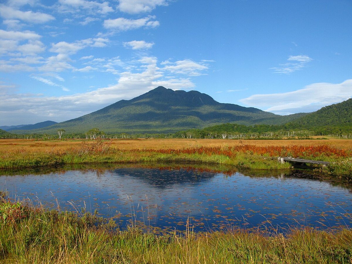
Hiuchigatake 燧岳

| Elevation | 2,356 m (7,730 ft) |
|---|---|
| Location | Fukushima, Japan |
| Region | Tohoku |
| Famous Mountains list | No. 28 of the 100 Famous Japanese Mountains (Nihon Hyaku-meizan) |
| Coordinates | 36.95298° N, 139.28716° E |
It's a volcano in the southwest of Fukushima. The top of the mountain belongs to the village of Miyagi. This is the highest peak of the Tohoku Hokkaido (including Tohoku region) at altitudes 2,356 m. The southeast foot of the mountain is the Vesse swamp, within the National Park, and the mountain that represents it along with Mount Shibutsu. It's been selected as one of the 100 Famous Japanese Mountains. The name of the mountain is derived from the fact that the remaining snow, visible from below, is similar to the burning of fire.
Overview
The summit is designated as a special protected area in Suse National Park. As part of the National Park of Sun, 1953. It's also defined as a protected forest area. There are five peaks near the crater: From the left you can see the red nuggets, from the left you can see the two peaks from the left. The mountain roads are connected by three of them, and they are tied in this order. There's a two-sided triangle on the screen, Hiuchigatake.
Eruption
It is estimated that he was a active volcano, made up of Fukuyama-Sai sites, and that he was starting his volcanic activity around the eruption of Moccaques and the embers that started about 160,000 years ago. About 8,000 years ago, the mountain population collapsed, resulting in a tail swamp. There's no literature on the eruption, but it's clear from the study of the eruptions that some 500 years ago, a day-site mamma and a lava dome formed. It's estimated that there was an eruption at the same time in 1980. It's also estimated that there was a small explosion in the pond in Kasai about 1544. It is recorded in the book that a flood containing white clay, called "The White Hike Water," occurred in the village of Zheng Hegi on July 28, 1544. This is estimated to be lahars caused by a steam eruption caused by a steam eruption in the estuary.
Climbing
In 1889, Nagano Shiramoto climbed to the top of the mountain and erected a stone on top of it. In the year 1890, he opened a field cabin in Randon dashi, which is commonly referred to as the "year of Mt. Fuji. " By 2010, there are four mountain roads from four directions. Because it's covered in the forest, there's little desire for it until we get close to the top. There's no cabin in the mountains again.
Other
As Fukushima
Text adapted from the Japanese Wikipedia article 燧ヶ岳, whose full text was translated into English for this guide by its contributors, licensed CC BY-SA 4.0. Elevation and location facts cross-checked with Wikidata (CC0) and the 100 Famous Japanese Mountains list (Japanese Wikipedia, CC BY-SA 4.0).