Home / Mountains / Mount Kobushi
Mount Kobushi 甲武信岳
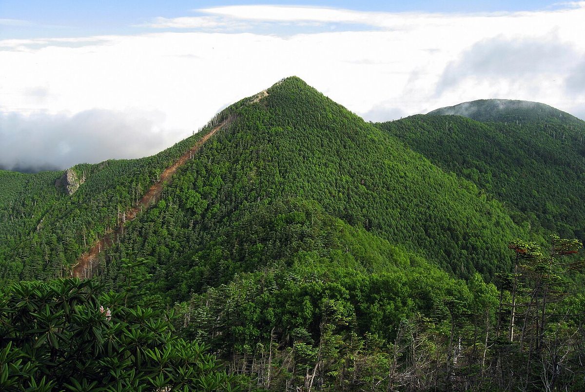

| Elevation | 2,475 m (8,120 ft) |
|---|---|
| Location | Saitama, Nagano, Yamanashi, Japan |
| Region | Kanto |
| Famous Mountains list | No. 67 of the 100 Famous Japanese Mountains (Nihon Hyaku-meizan) |
| Coordinates | 35.90889° N, 138.72889° E |
It's located in the center of the heart of the mountain, in the three prefectures of YamanashiZQ107X ZXZQQQ102X. I also call it zXQ15xbubbles. The theory is that it is named because it is located at the border of the Muslim state: NaganoX (Yamanashi), and because it appears to be the fist of the mountain. It's the source of the water (when you enter the Niigata) There is no triangle on the top. Also, the altitude at Three Treasure Mountain is slightly higher. From the top of the mountain, you can see 43 of the 100 mountains.
Climbing
There are the following courses in addition to the runways from the Xinjidong Pass and from the Master of the Country.
From the chrysanthemum of the Nagano River
There's a free parking lot on the Nagano side with a toilet on the brush and a maintenance climber. It's about an hour and a half before I reach Mount Fuji. It's the shortest course to do a test through the Kansaki-sama-sama walkwalk, and it's possible to get home from day to day in the morning. Or, "I'm also popular with my climbers on the round trip around Chikimoto Shikoku. It'll take about two hours longer than Piston, but it's possible for a good rider to return from the day.
From the Valley of Nishizawa in Yamasaka City
Rather than climbing from the Nagano, access from Tokyo is good, but it takes 5 hours and 40 minutes to climb, and it comes home hard. Buses are coming from the JR central train train station, Yamayama City Station, to the entrance of Nishizawa's valley. Most of the way up the mountain, there are trees in the forest, and few places to look forward to, but there are a lot of shovels growing on their own. The time of the Shaknag is from late May to June.
The cabin around here
The hut of Kozato-kun.
The neighboring mountain
Ten letters pass. Mihoyama. Kimura Mountain. Ichiyama.
Text adapted from the Japanese Wikipedia article 甲武信ヶ岳, whose full text was translated into English for this guide by its contributors, licensed CC BY-SA 4.0. Elevation and location facts cross-checked with Wikidata (CC0) and the 100 Famous Japanese Mountains list (Japanese Wikipedia, CC BY-SA 4.0).