Home / Mountains / Mount Tekari
Mount Tekari 光岳
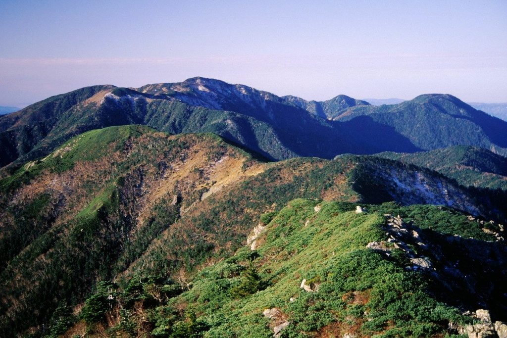

| Elevation | 2,591 m (8,501 ft) |
|---|---|
| Location | Nagano, Shizuoka, Japan |
| Region | Chubu |
| Famous Mountains list | No. 86 of the 100 Famous Japanese Mountains (Nihon Hyaku-meizan) |
| Coordinates | 35.33806° N, 138.08389° E |
It's been selected for the 100 Famous Japanese Mountains.
Overview
It's only 10 seconds south, and 300 meters south, and it's at the southernmost point in Japan, over 2,500 meters. The peak is slightly out of the forest, and the southernmost high pines, which are the distribution of high pines and high-alarm vegetation, are also known to hit the southernmost regions of the world's southernmost self and the butterfly home. The top of the mountain is designated South Alps National Park. The coniferous forests of the south east, such as Tuga, were designated by the Department of Environment on March 22, 1976. Just east of the peak lies a cabin of lighthouses, and the Senji River between Izalga and Izalga is a double-line line, where you can see the striped surface of the turtle-sized earth, the remains of the glacial glacial terrain. You can see alpine plants such as the Haksangkinbai, the Haksanghuo, and the sootybabite. Around luminous rocks, there are swarms of fabrics, such as chrynosquito and the unique species of southern Alps.
It comes from the mountain name
In the history of Isegawa, it was once called "Iseshima Hotel." When you look far away from the distant side of the summit, to the southwest, you see the white light in the evening. There is a limestone boulder called the Light Rock, which comes from the mountain. During the Meiji period, the land surveyor named it.
Climbing
When the Imperial Guard of the Japanese Mountain Council flew from Mount Akaishi, they wrote down this mountain name in the fifth year of its mountain record. In memory of the camp camp camped at the eastern edge of the Sunjihara, the site was named "Safe" In 1930, Kudo Kudo-do-do-do-do-do-do-a-do-do-do-do-do-do-do-do-do-do-do-do-it, along with a guide from Toyo, went back to Rinchozawa on the tributary side of the Oshima River, and the source was named "Aozawa." In the summer of 1952, Harada Kuyumi and her friends climbed the mountain from Ebina.
The climbing route
The climb road runs from Mount Hijiri Kashisha to Mt. Fuji's main path through the top of the mountain. However, if you are to climb from a hot spring again, you will have to walk about ten hours through the left side of the river. It's breaking down again. The peak is covered in trees, and the view is not good. You can see the elk and the elk on the climb road. The route from Eclipse. The route from the hot spring again. The south Alps runway. There is a level between the old Shizuoka High School and the Sunjihara, and the flowers and water fields are known to the climbers.
It's the cabin around here
On Shizuoka Mountain and on the Line, there are cabins and camp sites. I'm doing business with people during part of the climb season. It was opened in 1966 and became the third largest two-story hut in 1998. The dieting group, all under 50 years of age and under three, has set up a unique condition that only the climbers will do it by 3:00 p.m. In South Alps National Park, it's a ban on all mountain groups except camp stations. Outside the business period, some of the shelters have been released.
Waterfield
The waterhole at the north end of Shizuru - it is often clear and sunny. At the bottom of the garage south of the shed.
Access to the mountain entrance
Nagano When it comes to public transportation, there is no public transportation system near the island of Tokishima at Mount Hijiri. We're going to get off at Ikita Station or Fukuoka Station at JR Yashida Line. We're going to have to take a taxi, or we're going to have to use a taxi after moving from there to a rail bus. In your own car you will enter a distant country using Nagano path 251 from Kashita. In the case of car use, the Tokyo side has the Shinkaoka International Intervention. If access is made from either side, it will run a long, narrow mountain road and may be blocked by falling rocks or mud slides, which is a very strict route. At the end of Hatake's First Dam, there's a gate in the swamp, and the Tohoku way is beyond, where the public cars can't get in, so you park in a designated location. The trail across the Great Bridge, which is about two and a half miles from Numazu, is the mountain route up to Kasai.
Geography
It's on the main line of the southern Red Stone Mountains. There's about a mile to the east from the top of the mountain. About two and a half miles west of the summit lies Kashan Mountain, 2,419 meters.
The river from the source stream
It's at the root of the river below that flows into the Pacific. Toshizawa. I'll be back in the stream.
TV show
NHK combined TV, broadcast on January 31, 1982. the 100 Famous Japanese MountainsZXZXXXXXQ1212X NHK satellite 2 TV John, broadcast on December 13, 1994.
A related library
"The Southern Alps and the Ice Age" from Shizuoka newspaper, December 2008. ISBN 9784783805458. "3rd and 6th of the hut" from Mountain and Tsubagakure, October 2008, 3511-316. ISBN 978463533,0008. I'm sure you'll agree. ISBN 978463523719. Nagano Mountain. ISBN 97846352658. "Arpen's Guide 10" and "The Southern Alps" ISBN 978463513581.
Text adapted from the Japanese Wikipedia article 光岳, whose full text was translated into English for this guide by its contributors, licensed CC BY-SA 4.0. Elevation and location facts cross-checked with Wikidata (CC0) and the 100 Famous Japanese Mountains list (Japanese Wikipedia, CC BY-SA 4.0).