Home / Mountains / Mount Utsugi
Mount Utsugi 空木岳
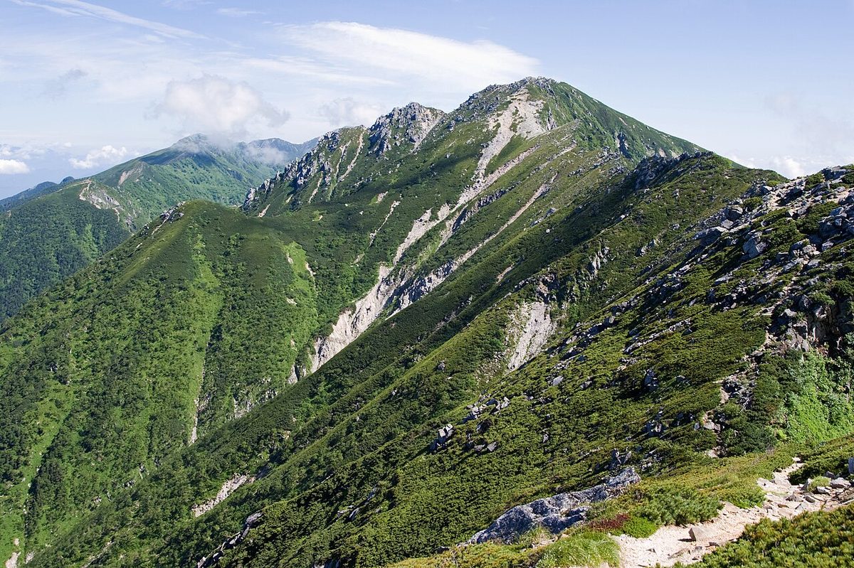

| Elevation | 2,864 m (9,396 ft) |
|---|---|
| Location | Nagano, Japan |
| Region | Chubu |
| Famous Mountains list | No. 75 of the 100 Famous Japanese Mountains (Nihon Hyaku-meizan) |
| Coordinates | 35.71889° N, 137.81694° E |
Mount Utsugi (just the bill) is a mountain of 2,864 meters. In addition to the Mount Kisokoma mountain range, it is the highest mountain in Japan, selected for the 100 Famous Japanese Mountains. In 1951, I was designated as the Central Alps Nature Park and the Central Alps National Park. When the author of the "the 100 Famous Japanese Mountains" was writing the same book, he was lost in his attempt to select one from the southern half of the tree, and the result was that he was eventually slightly taller, and he chose a tree from the beauty of the mountain. There's also a double triangle on the top of the mountain, and the boulder's big rocks are littered. To the northeast of the summit is the northeastern tip of the sky, and beyond, there is a massive stone called "Tikstone" on the line. There's an empty shelter in an empty cabin in the sky flat Carl, which extends east-east.
It comes from the mountain name
The mountain's name is attributed to the fact that when I looked up from my husband's valley at the foot of the mountain in spring, I saw only the top of Mount Utsugi snowline, and that residue of snow was similar to that of a pea. There is also a theory that it comes from the fact that there are a lot of cedar trees. The saddle section down to the west is called the King's Highness. In the old days, he said, "I'm Seung Jo."
The natural environment
The mountain range is a rock range of granite and is the white gravel. The east east side of Mount Utsugi is a valleyal region called turquoise Carl and a treasure chest of alpine vegetation in the forest's forested high pine range. From the north side of the Tohoku River, you can see the pyramided Mount Utsugi that stands in front of you. The butterfly that was seen around the area from 1960 to the following year is not confirmed. In the vicinity, the wind often blows on the west, and when the wind turns on the other side, it often becomes a change in the weather.
The peripheral motion plant
At the top of the mountain range, there are Okojo, Hoshi, and Iwai, and on the slopes of the mountain are elk deer and elk deer. In the sky on the east slope, you can see mountain plants such as cingumma, hakang, tagkin' knife, and antawan bush.
It's the cabin around here
The private cabin in the central Alps is a full reservation. The only place to camp is at the Kotakayama estate.
The surrounding mountains
It's on the main line of the central Alps. To the east, you can reach the pond ridges and the southeast ridges. The saddle section with Tokugawa in the northwest is called Sungigi.
Mr. Kim Jong-un
An altitude of 2497 meters between Mount Utsugi and Tohoku Tohoku on the west. There is a legend that in the 1180th anniversary of the peaceful era, the juju has gone beyond Yogi Yoichi. There is a waterhole on the mountain called "The Power of Peace." When it's dry, there are times when it's dry. There's a Morisawa Fujisawa house.
The river from the source stream
This is the main source stream that flows into the Pacific and Ise Bay. (The tributary of the Tokuta, the Tokita, the Tokugawa, and the Togo River) I'm sorry, I'm sorry.
Traffic access
The nearest Interchanger is the component of the central automobile road. The nearest station, the husband, is at the Department of Departments at JR Kanto Tokita Line, and Hanzawa is at the Hanamoto Station on the central main line. If you're running above Mount Kisokoma on climbing, you may find that the Manjidashiki train is used.
Text adapted from the Japanese Wikipedia article 空木岳, whose full text was translated into English for this guide by its contributors, licensed CC BY-SA 4.0. Elevation and location facts cross-checked with Wikidata (CC0) and the 100 Famous Japanese Mountains list (Japanese Wikipedia, CC BY-SA 4.0).